
Wootton
Wootton
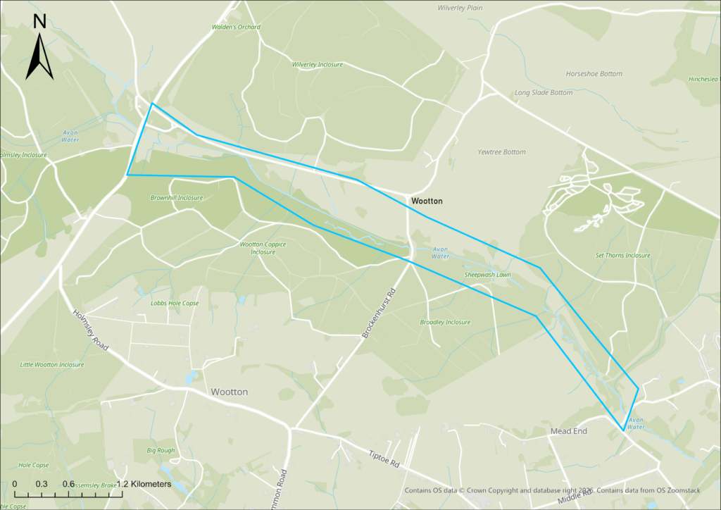
Beginning in 2016, a two-phase restoration project transformed 2.5 miles of riverine woodland along the River Avon at Wootton by infilling artificial drainage channels, raising the riverbed and removing spoil embankments to reconnect the river with its floodplain.
The work restored natural meanders, extending this stretch from 1,700m of straightened channel to 2,159m, slowing water flow and erosion while enhancing riverine woodland and wet grassland habitats.
What were the issues?
Around 1860, at a time when commercial conifer plantations began in the New Forest, the River Avon was straightened leading to ever-increasing erosive energy incising the channel bed in Wootton Inclosure.
At some points, the channel bed reached up to two metres deep. It got to the point where restoration was unavoidable.
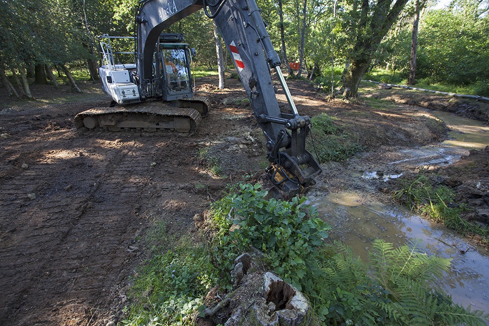
What was done?
A two-phase restoration project at Wootton between 2016 and 2019 infilled drainage channels, reinstated the old meanders, removed side drains, and created a new stock crossing to restore the river’s natural course.
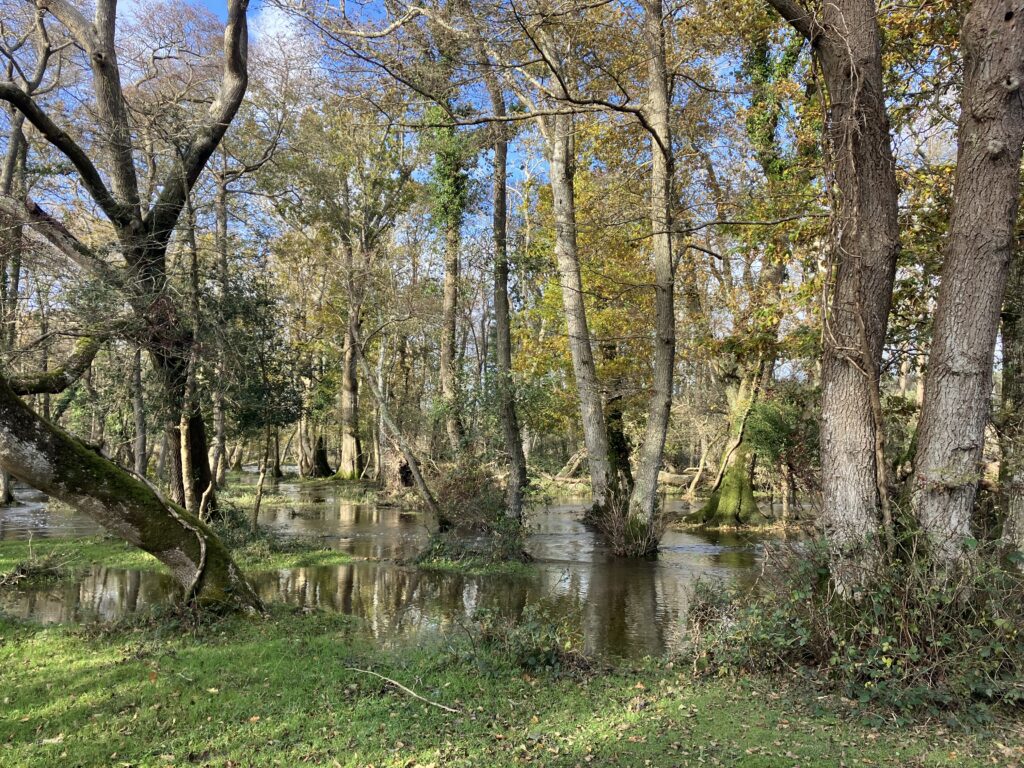
Monitoring has since shown improved natural functioning, greater habitat diversity and stronger floodplain interaction, with a 2025 report by Footprint Ecology concluding the work has slowed flows, enhanced wooded floodplain habitat, maintained high water quality and potentially reduced downstream flood risk.
What was the impact?
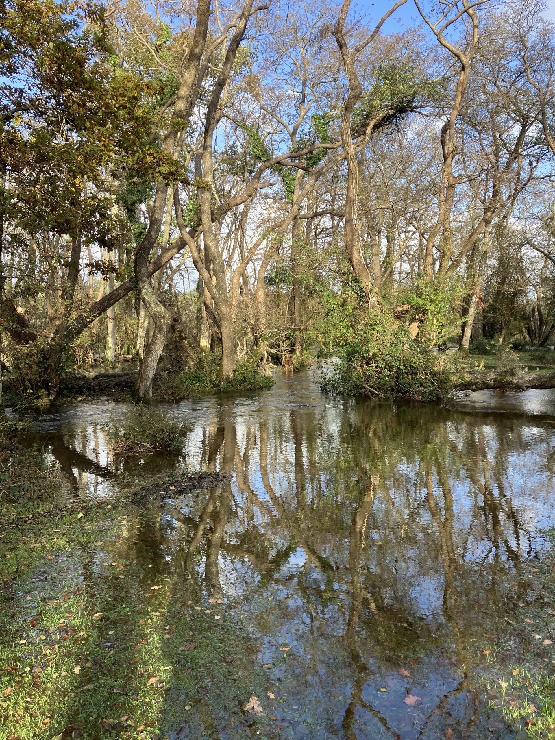
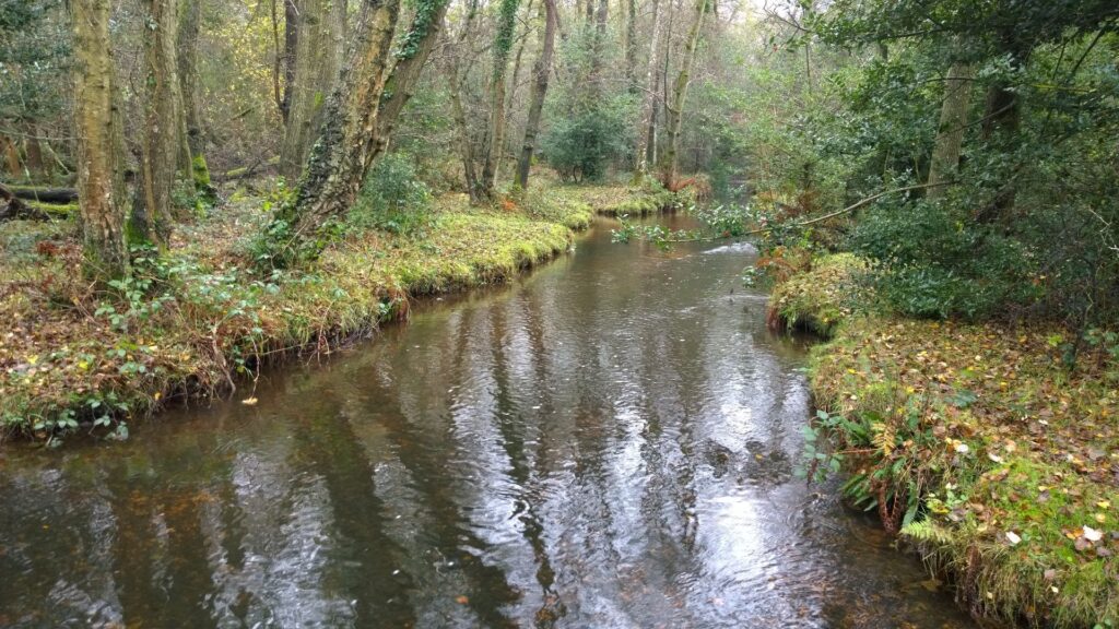
This work has transformed the area. Once a straight, monotonous channel, the Avon Water, is once more a dynamic and sinuous river.
Where before, water was being shot down an increasingly eroded, straightened channel, it now comes out of bank during higher flows, spreading naturally across the floodplain. This helps slow the flow of water and reduces the volume of water being transported downstream at any one time.
The re-meandering has reintroduced a wider range of flow speeds, water depths, channel features and sediment types within the river, and this greater variety of micro‑habitats allows a broader range of species with differing ecological requirements to colonise and persist within the river.
Monitoring has since shown improved natural functioning, greater habitat diversity and stronger floodplain interaction, with a 2025 report by Footprint Ecology concluding the work has slowed flows, enhanced wooded floodplain habitat, maintained high water quality and potentially reduced downstream flood risk.
'Through our survey work, we've been lucky enough to see the changes brought about by the restoration work at Wootton over the years. Although there is plenty of data describing changes to specific variables, for me it’s really just being there that brings home the value of restoration work - experiencing first hand the gently flowing, meandering watercourse with its pools, shallows and aquatic plants, the grazed glades and thickets of scrub interspersed with rejuvenating Alder coppice and tall fen vegetation and the wilder corners with fallen deadwood and quaking mosses.'
Sophie Lake, Footprint Ecology