

19 May 2026
Monitoring Wetlands
Wetland monitoring
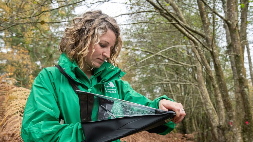
A range of monitoring techniques and specialist surveys are used to evaluate how effectively the wetland restoration programme is delivering its intended outcomes.
The monitoring framework is guided by the principles set out in the monitoring section of the New Forest Freshwater and Wetland Restoration Plan, developed by the Freshwater and Wetland Restoration Forum (FWRF).
Restored wetlands take many years to recover and return to a healthy condition, so Forestry England is still in the early stages of post‑restoration monitoring.
However, the framework provides a consistent and structured way to track progress, measure success against clear objectives and identify where further work may be needed.
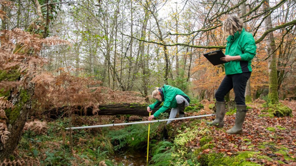
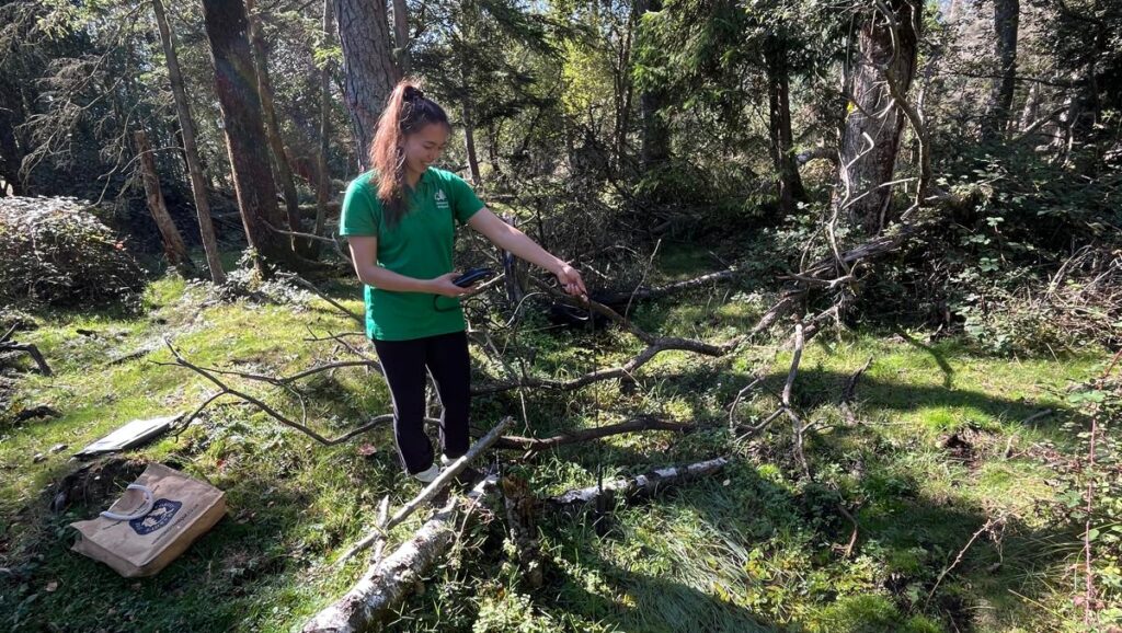
Habitat and botanical surveys
The New Forest’s wetland habitats are among the most ecologically significant in the UK.
Over two-thirds of all UK wetland plant species can be found here – around 300 species – while 30 per cent of England’s threatened freshwater species depend on these habitats.
The area contains the largest lowland valley mire complex in the UK, recognised as being of European and international importance.
Restoration is needed as many wetlands in the New Forest have been degraded over time by drainage and other human interventions.
Restoration work aims to reverse these impacts and allow natural wetland processes to function once again.
Measuring success
To assess how successful this work is, Forestry England maps habitats before and after restoration. However, because New Forest wetlands are so distinctive, they do not always fit standard habitat classifications.
To address this, the Freshwater and Wetland Restoration Plan sets out detailed descriptions of New Forest wetland habitats in their optimal, undisturbed condition.
These act as benchmarks to help us judge how well restored areas are recovering.
Alongside habitat mapping, detailed botanical surveys are carried out to understand the extent and quality of recolonising vegetation.
These surveys reveal whether characteristic New Forest wetland plant communities are returning, expanding, and functioning naturally.
Developing a robust monitoring approach
Forestry England commissioned Footprint Ecology to trial these monitoring methods on previously restored sites (see case studies below).
This work successfully refined a comprehensive approach to tracking habitat recovery.
Using this approach, all wetland sites restored last year have now been surveyed, creating a baseline for long-term monitoring.
Follow-up surveys will show how well each site is responding to restoration and help guide future work.
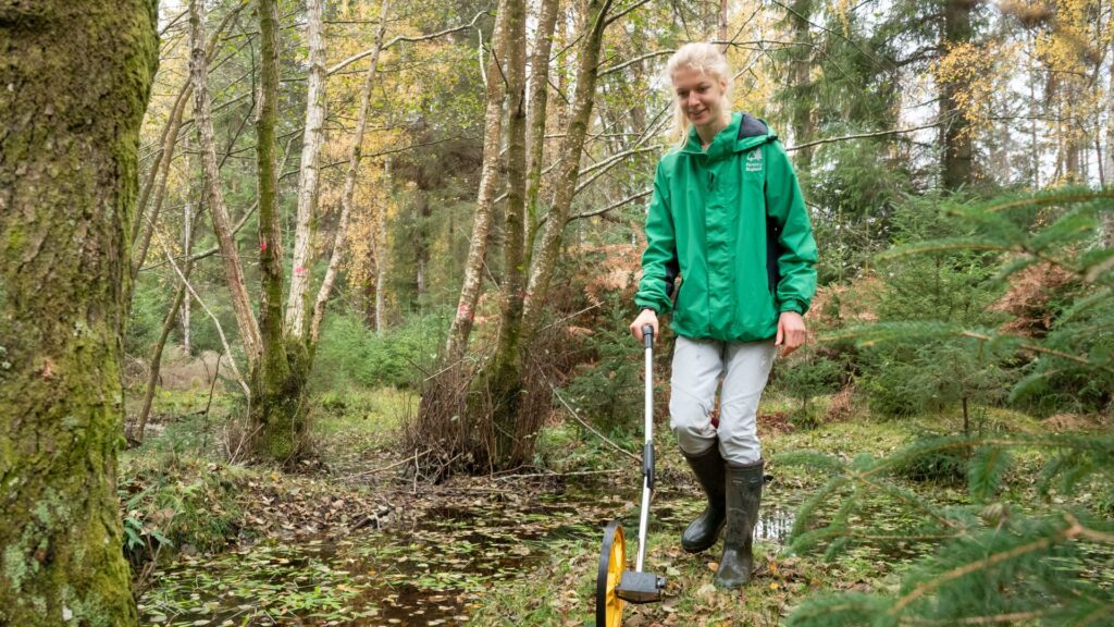
Geomorphology
Measuring the physical characteristics of rivers and wetlands helps us understand how these systems have been altered and whether they are functioning as naturally as they should.
This information not only guides what type of restoration is needed, but also allows us to assess whether completed restoration work has improved the condition of the site.
Forestry England has developed a comprehensive, bespoke geomorphological survey programme to monitor its wetland restoration work.
These surveys look at both the channel and the riparian edge to assess how they interact with each other.
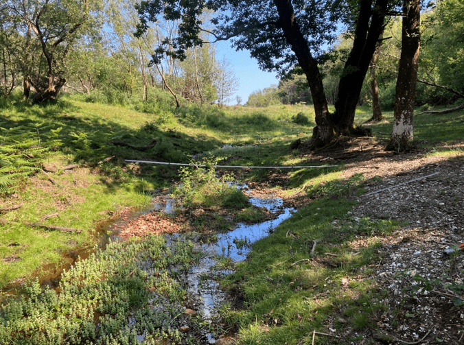
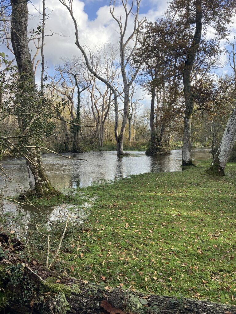
The Noads Mire
The Noads Mire is one example of how geomorphological surveys work in practice during New Forest habitat restoration.
In the past, artificial drainage channels caused water to flow too quickly through the mire, leading to erosion. Restoration work has helped create a more natural watercourse, allowing water to spread more gently across the landscape.
Work first took place between 2017 and 2020. The artificial drain was filled in and the bed level raised so that water could flow as a shallow stream. Heather bales and locally dug gravel, known as hoggin, were used to reshape the channel, while material from nearby spoil banks was spread across the site to reconnect the stream with its floodplain.
Further work downstream returned the watercourse to its original route, where traces of old meanders remained. Recovery was initially slower than expected due to thin soils, limited vegetation and heavy rainfall soon after the work.
Repairs were carried out in 2022 to stabilise areas where erosion had occurred. Since then, the site has shown clear signs of improvement, with reduced erosion and increased vegetation growth helping the mire recover.
Geomorphology report
Fixed Point and Timelapse Photography
Forestry England has developed a comprehensive fixed point photography programme to help monitor its wetland restoration sites.
Photos are taken before and after restoration work and used to assess the impact of restoration work on the form and functioning of the streams and wetlands.
These help measure the outcomes of the restoration against the criteria developed by the Freshwater and Wetland Restoration Forum.
See the Furzey Lodge and Hawkhill Mire case study for an example of how fixed point photography is used for monitoring.
Timelapse photography
Using field cameras, Forestry England as part of the HLS scheme monitor river levels and floodplain interactions at various sites in the New Forest, both before and after wetland restoration.
During high rainfall events, the floodplain interactions have been significant on restored channels such as the Avon Water at Wootton.
Knightwood timelapse video - November 2025 to January 2026
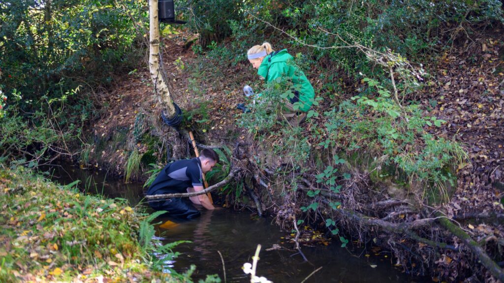
Water quality
Water quality is an important consideration at all restoration sites.
Forestry England monitors key water quality parameters using an Aquaprobe, including pH, dissolved oxygen and electrical conductivity.
Phosphate and nitrate/nitrite levels are also measured at each site to help assess nutrient conditions and detect any potential pollution issues.
Changing water levels are measured using water level loggers which collect information on absolute pressure and water temperature.
Recording water levels is a good tool for predicting flood risks, as well as showing the effects of any restoration work.
Other surveys
Forestry England frequently collaborates with external organisations and specialist consultants to commission survey work that helps measure the impact of restoration projects and guide future management.
For example, the Environment Agency supports Forestry England by deploying water-level monitoring equipment to assess how restoration work influences flood peaks. They also carry out fish surveys, ensuring that any necessary mitigation measures are identified to minimise impacts on fish populations.
Forestry England is also working with Freshwater Habitats Trust on a partnership wetland restoration project. As part of this work, water-level and eDNA monitoring has been undertaken, alongside vegetation, botanical, geomorphological and fixed-point photography surveys.
A range of species surveys are also commissioned to help inform management decisions.